FRENCH BROAD RIVER & VALLEY VIEWS
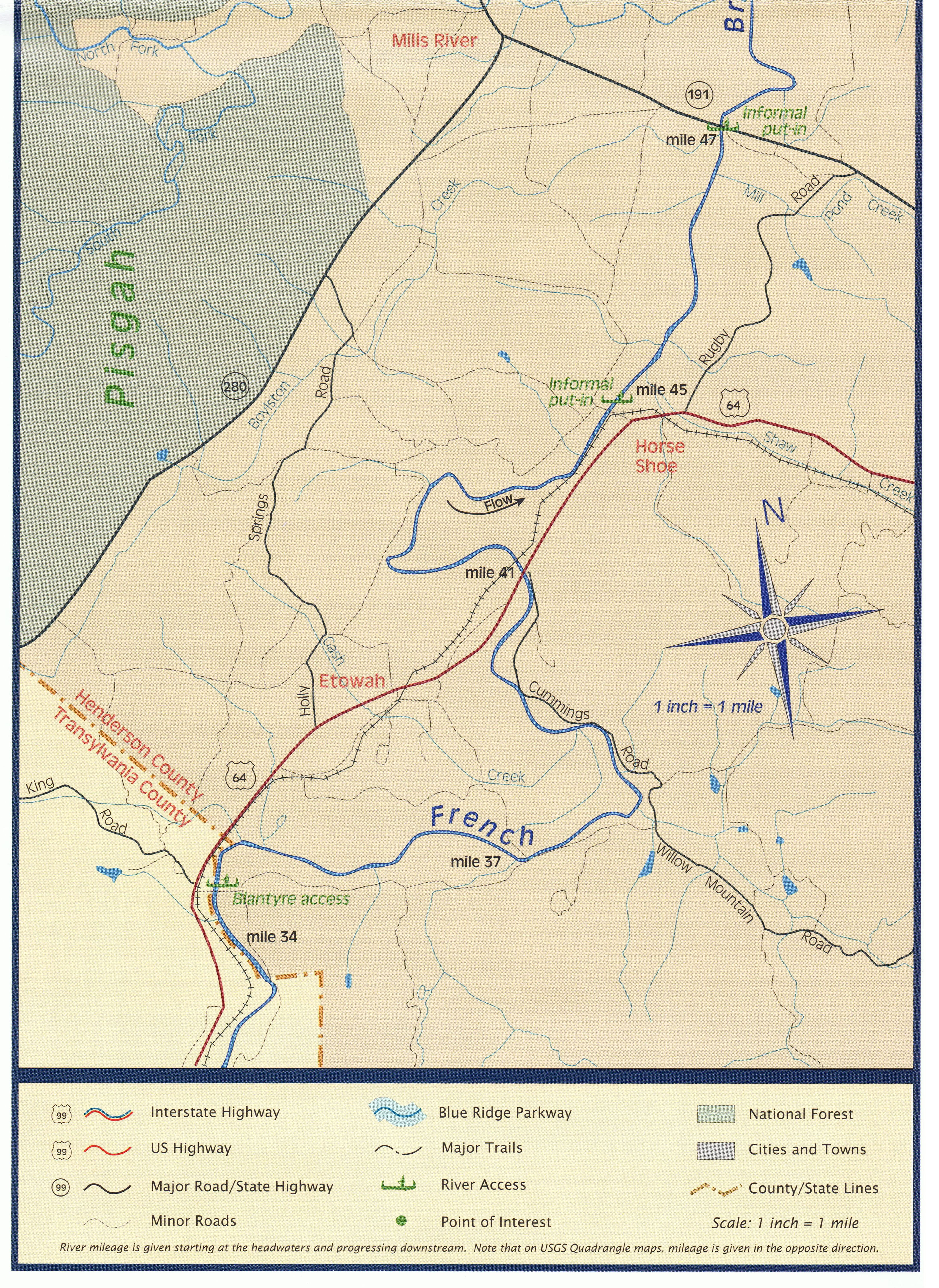
Etowah lies at approximately mile 37 from the headwaters of the
French Broad River near Rosman.
Map: a section of the "French Broad River Map & Guide" source: Riverlink.org
French Broad River near Rosman.
Map: a section of the "French Broad River Map & Guide" source: Riverlink.org


1930s or '40s (date unknown ?) - Standing on the frozen French Broad River at the Blantyre Gauge. L to R, Winborn Gash and Claude Davis of Blantyre.

Excerpts, Wilma Dykeman's book, "The French Broad" 1955
"South out of the green heights of Pisgah National Forest the North Fork of the French Broad tumbles past Piney Mountain and Spice Cove and Panther Mountain to join the West Fork of the river. For a unique feature of the French Broad is that it begins with four large tributaries flowing from the four cardinal points of the compass and all called by the river's final name. From the little township of Rosman where the four join to create the main stem of the French Broad, it follows a sinuous northerly course through narrow but fertile bottom lands and receives two more rivers, the Davidson and the Little, before it enters Henderson County, twice the population of its neighbor Transylvania, where the bottom lands become wider and Mills River quietly joins its course and Mud and Cane Creeks enter from the east. Just south of Asheville the plain Hominy and the poetic Swannanoa become part of the French Broad." (pg 8)
"South out of the green heights of Pisgah National Forest the North Fork of the French Broad tumbles past Piney Mountain and Spice Cove and Panther Mountain to join the West Fork of the river. For a unique feature of the French Broad is that it begins with four large tributaries flowing from the four cardinal points of the compass and all called by the river's final name. From the little township of Rosman where the four join to create the main stem of the French Broad, it follows a sinuous northerly course through narrow but fertile bottom lands and receives two more rivers, the Davidson and the Little, before it enters Henderson County, twice the population of its neighbor Transylvania, where the bottom lands become wider and Mills River quietly joins its course and Mud and Cane Creeks enter from the east. Just south of Asheville the plain Hominy and the poetic Swannanoa become part of the French Broad." (pg 8)

Wilma Dykeman 1920 - 2006
"To the Cherokee who roamed this country of the French Broad and had the legendary villages of Kanuga on the Big Pigeon and Kanasta on the French Broad, who hunted these forests and fished these waters, a river was part of their religion and livelihood, their commerce, their myth, and their recreation. . . .
Long Man, the River, fed by the tributaries of his Chattering Children, all the brooks and rivulets winding through the mountains. To the French Broad specifically they gave the name Agiqua, and for at least part of its length, the rapids below Asheville, they called it Tahkeyostee, meaning "Where they race." The Cherokees were right. This river needed several names to fit its several moods and natures." (pg 15)
About: "Mountain Lily" steamboat
on the French Broad River
1881 - Launched in nearby Horse Shoe
1885 - Ran aground at Kings Bridge, abandoned
on the French Broad River
1881 - Launched in nearby Horse Shoe
1885 - Ran aground at Kings Bridge, abandoned
Views of the Etowah Valley


Preparing the land for spring planting

Trestle over French Broad River, site of 1895 collapse when the 'Teapot' train was making its way down the tracks.