STORES OF EARLY ETOWAH

Where were the stores and various businesses in the Etowah community, prior to the late 1950s reconfiguration of Hwy 64?
BELOW: A close-up image from the 1942 Horse Shoe Quadrangle Map shows roads and some features, such as the railroad, brickyard kilns, churches, the 1928 Etowah High School, and Boylston Road - the original name of Brickyard Road.
Note how Schoolhouse Road (unnamed on the map) extended across Old Hwy 64 and on up to what is now Brickyard Rd. Also, Eade Road (unnamed) and the unpaved road that circled around Little Mountain. |
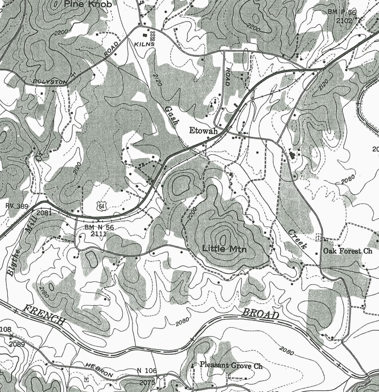
Map section cropped from the 1942 Horse Shoe Quadrangle Map
|
The Store & the Post Office
Across the land as communities gradually developed, the first stores and post office would often share one location, with the postmaster also being the shopkeeper. "Postmarks," by Lenoir Ray, pub. 1970. For the Etowah Valley, pp 299-302. These Etowah postmasters also operated stores, beginning in 1889. Collins, James A. - 1889 Greer, Ozark K. - 1892 Greer, Hugh J. - 1894 Laughter, Joshua M. - 1897 English, Charles O. (store owned by Jeudwine) - 1903 Chapin, Leslie A - 1907 |
McKINNA GENERAL STORE
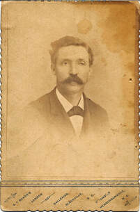
J. P. McKinna & Son operated a general store in the early decades of the 20th century, as early as 1913 (earliest known store ledger). It is believed to have had the first telephone in Etowah. James Perry McKinna 1860 - 1925 |
|
WHITEY'S
The owner was Donald Airens. It sat on present day Hendersonville Housing Authority property just off Misty Mtn. Lane which is directly behind Etowah Baptist Church on School House Road. There was a sawmill located behind the store. Charles Robinson lived in a house adjacent to the store and related that his family rented pasture land behind their house for a cow. This land was owned by Airens. On the side, Airens sold locally made white lightning which he stored under a rug covered trap door in the floor of the store. He was eventually caught and served time. The building was taken down in 1971 by Dessie and Jesse Norton and Dessie’s brother. Information for this article provided by Charles Robinson and Jesse Norton. |
GRAY'S (?)
A store Located on present Schoolhouse Road just before reaching the Etowah Baptist Church gym sat on a bank next door to the Tyree Duncan home and across the road from the Bradley residence. The owner was Roten Waldrop. The name of store is unknown at this time. Possible name Gray’s. |
1939 & 1941 ads in The Chief, Etowah High School Annual
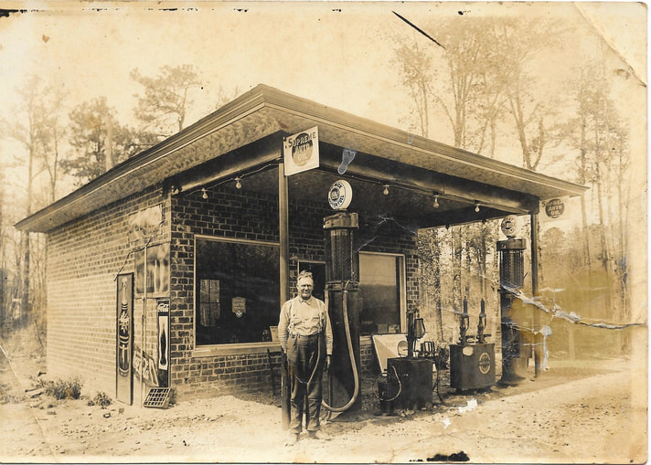
"Some referred to Mr. Whiteside as ‘Sleepy Whiteside’ because he would sit in a chair in front of the station and sleep while waiting for customers."
. . . a fond memory from a former resident of Etowah |
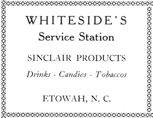
WHITESIDE'S
The brick building which housed the service station store stands today alongside Old US Hwy 64 / McKinney (McKinna) Rd. Whiteside's sold gas, snacks and a few other items. Owned and operated by Thomas Tuff Whiteside (1874 - 1962) Below - Tuff in front of Whiteside's Service Station, circa 1935 - 1940's. The station building, remodeled for private residential use today, still stands on McKinney Rd. Photo courtesy of Jerry Murphy, Tuff's great grandson. Another photo of Tuff in Big Willow. |
|
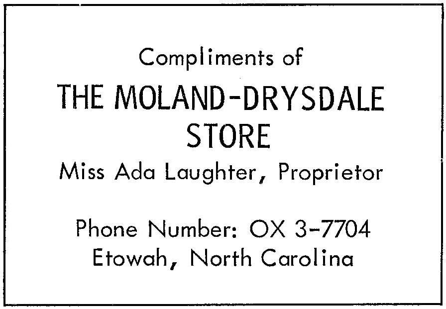
ADA's Store
aka, The Moland-Drysdale Store company store for the "Brickyard" Located at the present intersection of Brickyard Road and Holly Springs Road. It was operated by Ada Valeria Laughter (1909 - 1978). After the Brickyard closed in 1955, Ada purchased the contents and continued to run the store. Before being torn down, the store building was used to store golf carts. The store operated until at least 1960. The last school annual in 1960 includes an ad for the store. The 1959 ad includes the name, Miss Ada Laughter, Proprietor. |
Miss Laughter was robbed in the Brickyard store on August 26, 1957. She was hit over the head with a shotgun, and received 17 stitches at the hospital. Two 18 yr old's were arrested, John M. Parris and get-away-car accomplice Neal W. Norris Jr.
|
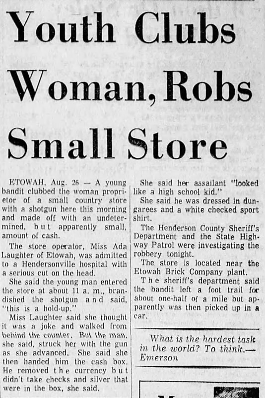
Asheville Citizen Times, Aug 27, 1957
|
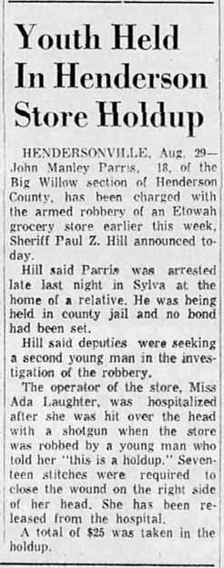
Asheville Citizen Times, Aug 30, 1957
|
|
BRANNON's
More info when it becomes available. 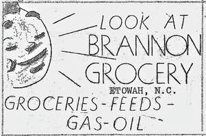
1946 ad, The Little Chief newsletter
|
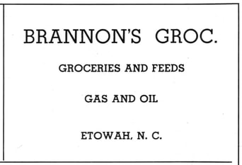
1947 ad, The Chief
|
|
C & P GROCERY
More info when it becomes available. |
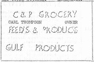
1946 ad from The Little Chief newsletter
|
|
W. A. WHITESIDE
William Arthur Whiteside (#### - ####) Located where a present day duplex apartment is, the corner of Old Hwy 64 and Oakland Hill Drive (formerly was called Sunset Hill Drive). Operated approximately 20 years from 1941 to the early sixties. Had a previous owner who lived in quarters at the back of the store. Sold gas, groceries and feed and seed. It was the stop for a bus carrying workers back and forth to the Ecusta paper plant. It was also the stop for the bookmobile from Hendersonville. Read more about Whiteside's store from descendant, Jerri Whiteside Lambeth
". . . the store my grandfather Whiteside had was previously owned by another family of which I did not write down their name. But they describe the store. The store had a large front to it. . . ." |
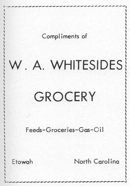
1956 ad
|
|
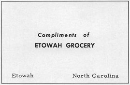
ETOWAH GROCERY
Located at the corner of Old Hwy 64 and Walters Dr. where Hawk Inside-Air now operates. Built by Anderson Banks in the late 40s or early 50s. Bought by brother Watson Banks in the early 50s and was sold by Watson in 1959. Sold gas and groceries. Watson, his wife and two children lived in an apartment at the back and basement level of the store. |
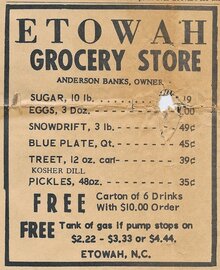
1964 Western Carolina Tribune
|
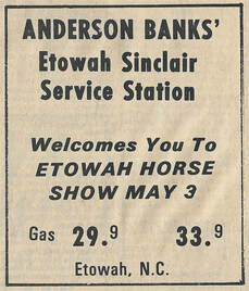
1969 Ad, Western Carolina Tribune
|
|
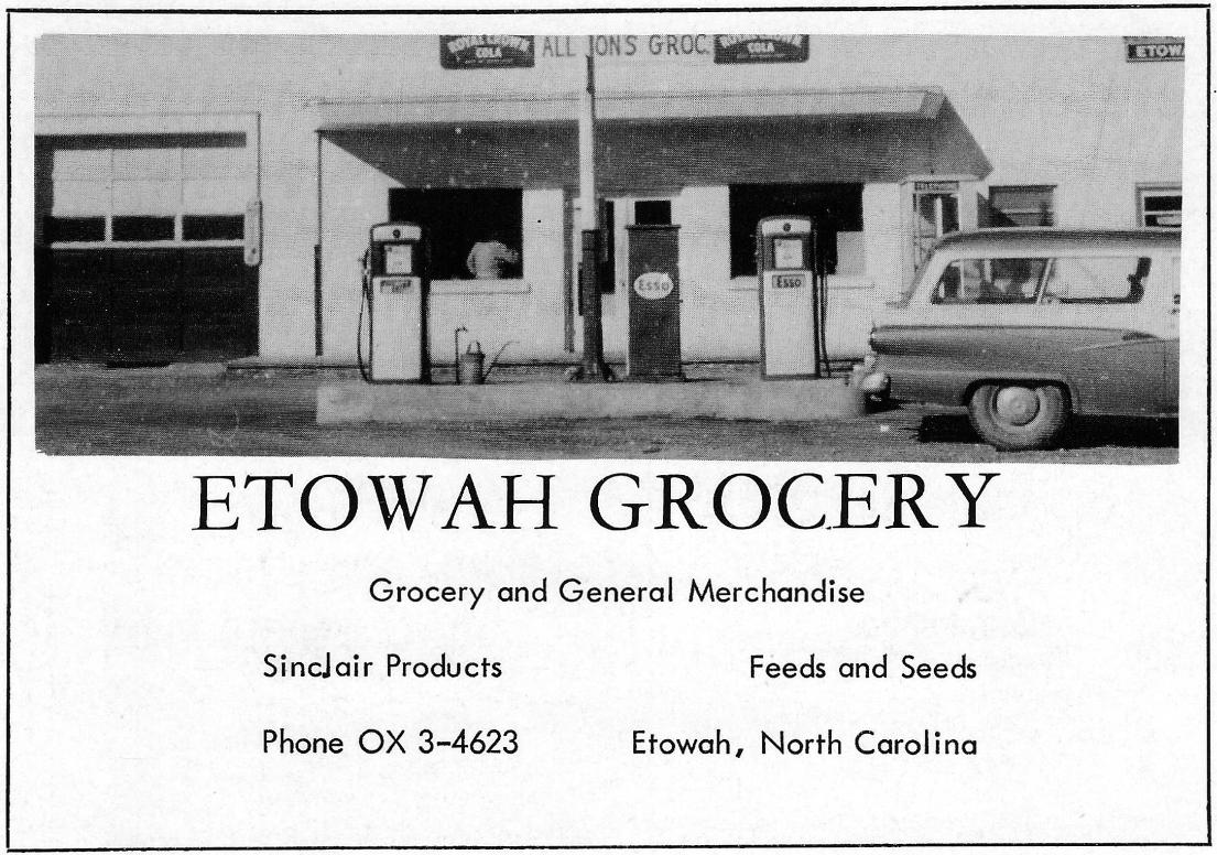
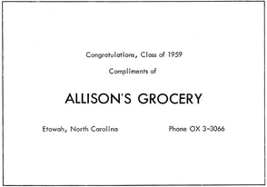
ETOWAH GROCERY, ALLISON'S
Melvin E. Allison (1918 - 2010) Located at the NE corner of Hwy 64 and Brickyard Road in the vacant building (currently for sale) in front of the Etowah Branch Library. Date building was erected and builder presently unknown. Operated by Melvin E. Allison with his brother Raymond Allison, before becoming postmaster at the Etowah Post Office until his retirement in the early 1980s. [memorial, findagrave.com] There were three sections of the building. Facing the building, the post office was on the left; the building in the middle operated as The Etowah Trading Post (Paul Chandler) and a garage was on the right. Dot and Larry McKelvin leased the Trading Post space from 1972-1974 as the Etowah Grocery and also sold gas. In later years, Betty Banks (####) operated the Corner Market, a friendly country store offering fresh vegetables, bakery items, gifts, collectibles. Currently vacant and for sale by Nicholson Properties of WNC LLC. 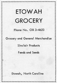
1958 ad
|
1960 ad
1959 ad
1953 ad
|
|
ETOWAH GROCERY / COMMUNITY SUPERETTE
If traveling west on Hwy 64, it was located on present Hwy 64 just before reaching the railroad tracks. Built by Anderson Banks and operated by Charlotte Moffitt. In addition to a grocery store, the building housed a laundromat, beauty shop and barbershop. Behind the building was a garage and auto parts shop owned by Joe Arbogast. This business was eventually bought and run by Lawrence Landers until Landers retired. The grocery business (but not the building) was bought by Cecil Young and his wife Girtrue in 1968. Cecil renamed the business Community Superette. Bea Capps helped run the grocery; Jane Watts worked there during her high school years. Cecil sold the business in 1982 to David Burnette where it continued to operate for a few years as a grocery. The building was eventually bought by Larry Owens who sold gas, tires, and hardware. In 2009-10 the building was replaced with a new building which housed a Carhartt clothing store and Etowah Hardware and Tire. The hardware portion of the business closed in 2015 and Carhartt closed in January 2016. JZM Auto & Tire anchors the corner property now, owned by , JZM Properties, LLC. |
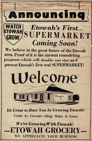
1968 Times-News ad, part of advertising campaign called "Watch Etowah Grow," welcoming Northwestern Bank (pictured in ad) (now Etowah Pharmacy & Dr. Newsom D.D.S.)
|
|
INGLES
It is believed that the Lions Club leadership reached out to Robert Ingle sometime during the 1960-70s asking for a store to be built in Etowah. As a result, Ingles became the anchor store in Phase I of the Etowah Shopping Center, built in the early 1970s by Lloyd Ducote. [Opening Day to be determined]. Ingles Corporation later purchased the corner of Hwy 64 and Etowah Park Rd and built the new Etowah Ingles of today. |
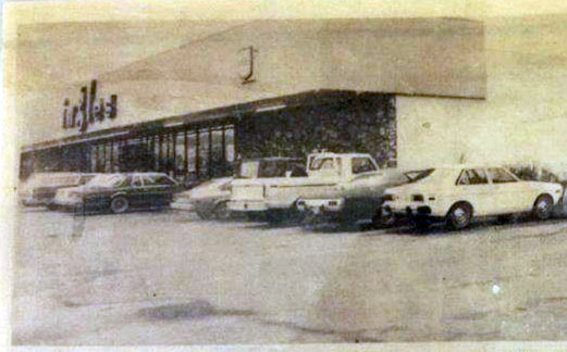
Ingles in its first location, anchor store in the Etowah Shopping Center, circa 1980
|
Research material for this page provided by Wanda Sumner Love and Friends